Doomsday Glacier: What Happens When Ice Loses Its Anchor?
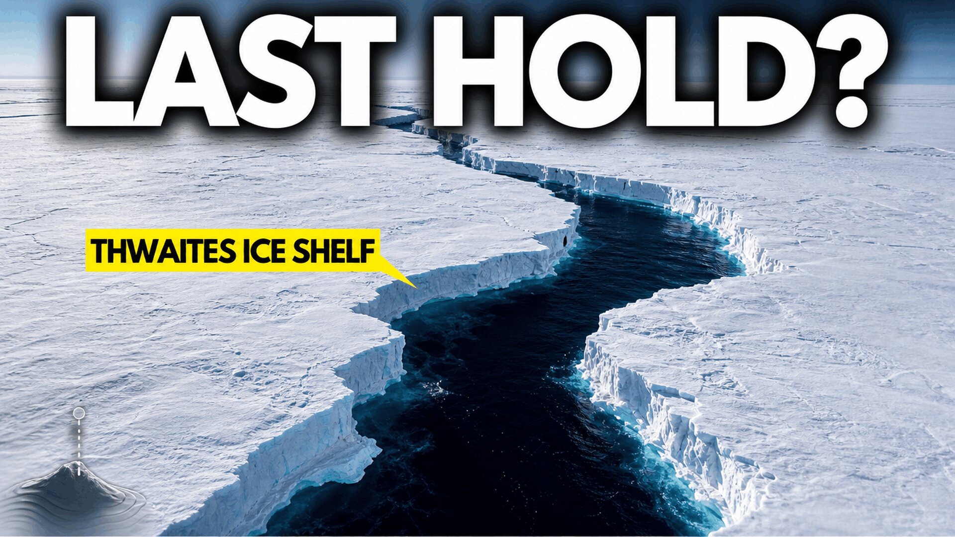
A single underwater ridge is the only thing holding Thwaites Glacier’s floating ice shelf in place, and new data show that grip is slipping.
Beneath the surface of the Amundsen Sea, one small point of contact is doing an outsized job. It is the last thing standing between a stable ice shelf and a much bigger problem for coastlines around the world. Scientists call it a pinning point, and it belongs to Thwaites Glacier, the Antarctic ice mass better known by its nickname: the Doomsday Glacier.
For more than two decades, researchers have watched this contact point weaken. But here is the twist: the shelf breaking apart isn’t actually what worries scientists most. The real danger is what that shelf has been holding back all along.
This article walks through what’s happening beneath Thwaites, why the physics of ice shelves are more counterintuitive than they sound, and what the science actually says (and doesn’t say) about the timeline for sea level rise.
A Glacier Split Into Two Worlds
To understand Thwaites, picture it in two parts.
Inland sits the grounded glacier, a mass of pale blue ice resting directly on bedrock. Past a boundary called the grounding line, the ice loses contact with the ground and starts to float, spreading out over the ocean as a bright white ice shelf.
About 40 kilometers out, that floating shelf runs into an underwater sill, a ridge of rock rising from the seafloor. This pinning point acts like an anchor. It’s a tiny patch of friction in an enormous ocean, but it does real mechanical work: by pressing against that ridge, the shelf resists the slide of the grounded ice behind it.
This is one connected system, not two separate pieces of ice. If that single point of contact fails, there’s very little left to slow things down.
Two Decades of Data Point to a Weakening Structure
Early satellite records from the 2000s showed a relatively stable ice shelf. But over the last twenty years, instruments coordinated through the International Thwaites Glacier Collaboration have tracked a slow, steady disintegration.
Most of the damage is concentrated in what’s known as the shear zone, a band of ice where stress builds up as the glacier pushes against the anchoring ridge. Multiple independent data sources tell a consistent story here:
- Satellite imagery shows fractures in the shear zone multiplying and widening
- GPS stations anchored to the ice confirm the shelf is expanding and thinning
- Airborne laser surveys show it’s losing internal cohesion
- Altimetry records show the surface is dropping, while ice flow measurements show shifting velocities
Ted Scambos, a scientific coordinator who has tracked this data over the long term, has helped interpret what these shifts mean for the shelf’s structural strength. The picture that emerges isn’t one dramatic crack signaling imminent collapse. It’s a structure that is gradually losing its ability to carry stress.
The exact timing of a full release from the ridge is still unresolved, but the trend of weakening is not in question.
Why the Ice Shelf Breaking Isn’t the Real Danger
Here’s the part that surprises most people: when a floating ice shelf breaks apart, it does not immediately raise global sea level.
That’s because floating ice is already buoyantly supported by the ocean. It has already displaced its own weight in water, the same way an ice cube melting in a glass doesn’t make the glass overflow. So the shelf collapsing isn’t the sea level event people picture.
The actual danger shows up after the shelf is gone. Without it acting as a physical barrier, the grounded glacier inland loses its lateral support, a force called buttressing. That support is what’s been holding back the massive volume of ice sitting on bedrock behind it. Remove it, and the grounded ice can slide toward the sea much faster.
This is why the real story of Thwaites isn’t a single dramatic event. The consequences unfold over decades and centuries, not overnight.
The Bowl-Shaped Bed That Makes This Worse
Thwaites sits inside a sunken marine basin, and the shape of that basin matters enormously.
The bedrock underneath doesn’t rise as you move inland, the way a typical hill would. Instead, it slopes downward, forming what’s called a retrograde bed that descends deeper into West Antarctica. Submerged channels in the seafloor funnel modified Circumpolar Deep Water, a warm, dense ocean current, straight into the cavity beneath the ice.
That warm water drives basal melting from below. As the ice thins and loses structural support, the grounding line retreats further inland. And because the bed slopes downward, each step of retreat exposes a taller, heavier wall of ice to the ocean, which then flows faster and pushes the grounding line back even more.
Scientists have a name for this self-reinforcing loop: marine ice sheet instability. It’s important to be precise about what that term does and doesn’t mean. It describes a possible pathway that researchers are actively studying, not a guaranteed or precisely timed collapse. Bed ridges can act as speed bumps, pockets of subglacial water and shifting ocean heat can slow the process, and there’s still real uncertainty in mapping a bed buried under kilometers of ice.
A Shared System: Thwaites Isn’t Alone
Thwaites is one piece of a larger network in the Amundsen Sea sector, alongside neighboring glaciers Pine Island, Smith, and Kohler. They all drain into the same basin, which means stress doesn’t stay contained to one glacier.
Think of it like a stone arch. Thwaites isn’t the entire arch, but it’s one of the load-bearing points, and that load is already shifting. This coupling between glaciers isn’t an instant domino effect. Stress can take decades to spread, and broader regional responses could take centuries. Local seafloor ridges and bed topography could also interrupt or slow the reaction.
Still, this shared connection is exactly why concern extends beyond a single glacier to the entire West Antarctic Ice Sheet.
How Much Sea Level Rise Are We Actually Talking About?
If Thwaites eventually loses all of its grounded ice, global sea levels could rise by roughly 65 centimeters.
That number is easy to misread. It’s not a sudden wave crashing onshore. It’s a long-term shift in the baseline height from which every future high tide and storm surge begins. And that global average won’t land evenly everywhere. The pressure will build gradually along vulnerable coastlines in places like Bangladesh, Florida, Shanghai, and the Maldives, worsening high-tide flooding and straining infrastructure over time.
Zoom out further, and a larger collapse of the West Antarctic Ice Sheet could represent several meters of potential sea level rise. These are decades-to-centuries scale changes, not overnight events, but the mechanisms driving them are already active today.
Pull quote: “The shelf breaking is simply the moment the story of our oceans changes.”
The Bottom Line
Thwaites Glacier isn’t defined by one crack or one collapse event. It’s defined by a slow, measurable loss of the structural support that has kept an enormous volume of ice in check for generations. The pinning point is weakening, the shear zone is fracturing, and the warm water reaching the grounding line isn’t going anywhere.
None of this means a fixed doomsday date. It means a system already in motion, one that scientists will keep watching closely for years to come. If this kind of deep-dive science content is useful to you, follow along or subscribe for more breakdowns of the research shaping our understanding of climate systems.